
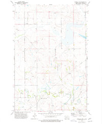
1973 Map of Dunn Center
USGS Topo · Published 1977About this map
Dunn Center serves as the focal point of this North Dakota landscape, situated along the Burlington Northern railroad corridor during the early 1970s. The region is defined by a complex drainage system featuring the meandering path of Slow Creek and prominent wetlands such as Boe Slough and Moffet Slough. Topographic variations are punctuated by landmarks like Clay Butte in the southeastern quadrant, while scattered artesian features such as a Flowing Well and several Spring sites indicate the importance of water access in this prairie environment. This survey provides a precise look at the rural infrastructure of the era, from the local Sewage Disposal Pond to the network of section lines and fences that demarcate the agricultural holdings of the Missouri Plateau.
Find a feature on this map
13 named features on this map. Tap any name to fly to it.
Don’t see what you’re looking for? This feature index may not catch every label — zoom into the map to look around manually.
Map Details
Editions of this 1973 Dunn Center Map
This is the sole edition of this map. No revisions or reprints were ever made.
Other maps of this area

1953 · Watford City
USGS Topo · 1:250,000

1957 · Watford City
USGS Topo · 1:250,000

1967 · Watford City
USGS Topo · 1:250,000

1970 · Dunn Center NW
USGS Topo · 1:24,000

1970 · Halliday NW
USGS Topo · 1:24,000

1970 · Dunn Center NE
USGS Topo · 1:24,000

1973 · Ziner Butte
USGS Topo · 1:24,000

1973 · Emerson
USGS Topo · 1:24,000

1973 · Werner
USGS Topo · 1:24,000
1973 · Marshall NW
USGS Topo · 1:24,000