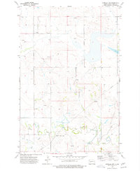
1973 Map of Marshall NW
USGS Topo · Published 1977About this map
The Knife River meanders through the southern portion of this Dunn County landscape, joined by the waters of Deep Creek. This rural North Dakota terrain in the 1970s is characterized by its agricultural and industrial utility, featuring several scattered Spring sites and small Well locations. The terrain label Myran identifies the southern upland area overlooking the river valley. Evidence of the region's infrastructure and resource extraction is found in the multiple Pipeline routes crossing the quadrangle and a Gravel Pit positioned near the center. Transportation is focused on the river and air, with a designated Ford crossing the Knife River and a remote Landing Strip situated to the north. This map captures the functional character of the High Plains, where the water table and mineral resources dictate the sparse but deliberate footprint of human activity.
Find a feature on this map
13 named features on this map. Tap any name to fly to it.
Don’t see what you’re looking for? This feature index may not catch every label — zoom into the map to look around manually.
Map Details
Editions of this 1973 Marshall NW Map
This is the sole edition of this map. No revisions or reprints were ever made.
Other maps of this area

1953 · Watford City
USGS Topo · 1:250,000

1957 · Watford City
USGS Topo · 1:250,000

1967 · Watford City
USGS Topo · 1:250,000

1973 · Marshall SE
USGS Topo · 1:24,000

1973 · Marshall SW
USGS Topo · 1:24,000

1973 · Ziner Butte
USGS Topo · 1:24,000
1973 · Hirschville
USGS Topo · 1:24,000

1973 · Halliday
USGS Topo · 1:24,000

1973 · Dunn Center
USGS Topo · 1:24,000

1973 · Werner
USGS Topo · 1:24,000