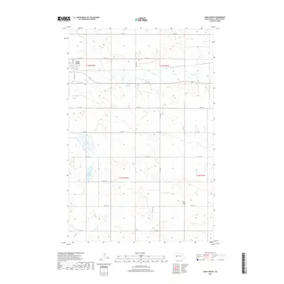
2018 Map of Dunn Center
USGS Topo · Published 2018About this map
Dunn Center serves as the primary hub of this North Dakota landscape, situated along the northern reaches of the quadrangle. The town's grid is defined by thoroughfares like Central Ave S and 5th St SW, which give way to an expansive agricultural and wetland system. Water dominates the western and southern reaches of the territory, where drainage patterns are marked by Boe Slough and Moffet Slough. The undulating terrain rises significantly at Clay Butte in the southeast, providing a distinct landmark against the surrounding prairie. A network of rural section-line roads, including 97th Ave and 10th St SW, connects the scattered farmsteads and fields throughout the township divisions of t145n r94w and t144n r93w.
Find a feature on this map
26 named features on this map. Tap any name to fly to it.
Don’t see what you’re looking for? This feature index may not catch every label — zoom into the map to look around manually.
Map Details
Editions of this 2018 Dunn Center Map
This is the sole edition of this map. No revisions or reprints were ever made.
Other maps of this area

1953 · Watford City
USGS Topo · 1:250,000

1957 · Watford City
USGS Topo · 1:250,000

1967 · Watford City
USGS Topo · 1:250,000

1970 · Dunn Center NW
USGS Topo · 1:24,000

1970 · Halliday NW
USGS Topo · 1:24,000

1970 · Dunn Center NE
USGS Topo · 1:24,000

1973 · Ziner Butte
USGS Topo · 1:24,000

1973 · Dunn Center
USGS Topo · 1:24,000

1973 · Emerson
USGS Topo · 1:24,000

1973 · Werner
USGS Topo · 1:24,000