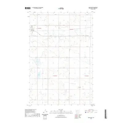
2020 Map of Dunn Center
USGS Topo · Published 2020About this map
Dunn Center serves as the primary settlement on this North Dakota prairie landscape, situated near the headwaters of Spring Creek. The terrain is defined by the subtle drainage patterns of the northern plains, where intermittent water features like Boe Slough and Moffet Slough collect in depressions between the low rises. A prominent local landmark, Clay Butte, rises to the south, overlooking a strictly organized section-line road network that includes 101st St SW and 97th Ave SW. This late-modern survey illustrates the enduring nature of the rectangular survey system, showing how modern ranching and agricultural access roads still follow the township and range boundaries established over a century ago, even as watercourses like Slow Cr meander independently across the grid.
Find a feature on this map
28 named features on this map. Tap any name to fly to it.
Don’t see what you’re looking for? This feature index may not catch every label — zoom into the map to look around manually.
Map Details
Editions of this 2020 Dunn Center Map
This is the sole edition of this map. No revisions or reprints were ever made.
Other maps of this area

1953 · Watford City
USGS Topo · 1:250,000

1957 · Watford City
USGS Topo · 1:250,000

1967 · Watford City
USGS Topo · 1:250,000

1970 · Dunn Center NW
USGS Topo · 1:24,000

1970 · Halliday NW
USGS Topo · 1:24,000

1970 · Dunn Center NE
USGS Topo · 1:24,000

1973 · Ziner Butte
USGS Topo · 1:24,000

1973 · Dunn Center
USGS Topo · 1:24,000

1973 · Emerson
USGS Topo · 1:24,000

1973 · Werner
USGS Topo · 1:24,000