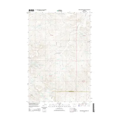
2014 Map of Dunn Mountain North
USGS Topo · Published 2014About this map
The Bull Mountains dominate this high-relief landscape in central Montana, where the border between Musselshell Co and Yellowstone Co cuts through the southern reaches of the range. The terrain is defined by a series of prominent peaks and elevated plateaus, including Johnston Mtn, Dunn Mtn, and the expansive Taylor Mesa. These features suggest a topography of significant elevation changes, deeply etched by a network of seasonal drainages and named springs like those feeding Fattig Cr and Rehder Cr.
Find a feature on this map
78 named features on this map. Tap any name to fly to it.
Don’t see what you’re looking for? This feature index may not catch every label — zoom into the map to look around manually.
Map Details
Editions of this 2014 Dunn Mountain North Map
This is the sole edition of this map. No revisions or reprints were ever made.
Other maps of this area

1954 · Roundup
USGS Topo · 1:250,000

1958 · Roundup
USGS Topo · 1:250,000

1979 · Roundup
USGS Topo · 1:100,000

1979 · Gage NE
USGS Topo · 1:24,000

1979 · Chimney Butte
USGS Topo · 1:24,000

1979 · Gage
USGS Topo · 1:24,000

1980 · Cherry Spring
USGS Topo · 1:24,000

1980 · Dunn Mountain South
USGS Topo · 1:24,000

1980 · Dunn Mountain North
USGS Topo · 1:24,000

1980 · Signal Mountain
USGS Topo · 1:24,000