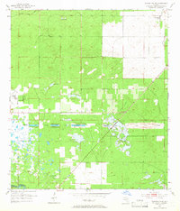
1954 Map of Dunnellon SE
USGS Topo · Published 1966About this map
The ambitious and ultimately failed Cross Florida Barge Canal project dominates this mid-century landscape through the Proposed Gulf Atlantic Ship Canal (Abandoned), which cuts a distinct horizontal swath across the terrain. This survey, based on 1950s data, reveals a Marion County interior defined by wet prairies and hammocks before the onset of modern suburbanization. To the south, the Withlacoochee River forms the boundary between Marion and Citrus counties, while the local community is anchored by the Cedar Grove Ch. The map captures a moment of transition in aviation and land use, documenting the Dunnellon Airport (Abandoned) and its Beacon, alongside established agricultural holdings like the Circle Square Ranch. Diverse water features such as Ross Pond and the Leroy Ponds dot the area, illustrating the complex hydrology of Ross Prairie and the surrounding woodlands of Adams Hammock.
Find a feature on this map
14 named features on this map. Tap any name to fly to it.
Don’t see what you’re looking for? This feature index may not catch every label — zoom into the map to look around manually.
Map Details
Editions of this 1954 Dunnellon SE Map
2 editions found

Other maps of this area

1892 · Dunnellon
USGS Topo · 1:62,500

1893 · Panasoffkee
USGS Topo · 1:62,500

1894 · Dunnellon
USGS Topo · 1:62,500

1895 · Tsala Apopka
USGS Topo · 1:62,500

1895 · Panasoffkee
USGS Topo · 1:62,500

1895 · Ocala
USGS Topo · 1:62,500

1954 · Holder
USGS Topo · 1:24,000

1954 · Romeo
USGS Topo · 1:24,000

1954 · Tsala Apopka NE
USGS Topo · 1:24,000

1954 · Dunnellon
USGS Topo · 1:24,000