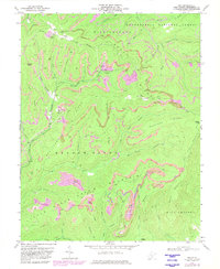
1972 Map of Duo
USGS Topo · Published 1982About this map
Strip Mines and industrial infrastructure dominate this portion of the Monongahela National Forest during the early 1970s. The extraction landscape is centered around the settlement of Duo, where the Chesapeake and Ohio railway serves a local tipple and slag dump. To the north, the Conrail line skirts the community of Cobb, navigating the complex topography of Beech Ridge and Bruffman Br.
Find a feature on this map
63 named features on this map. Tap any name to fly to it.
Don’t see what you’re looking for? This feature index may not catch every label — zoom into the map to look around manually.
Map Details
Editions of this 1972 Duo Map
2 editions found
Other maps of this area

1887 · Hinton
USGS Topo · 1:125,000

1887 · Lewisburg
USGS Topo · 1:125,000

1889 · Nicholas
USGS Topo · 1:125,000

1891 · Lewisburg
USGS Topo · 1:125,000

1891 · Nicholas
USGS Topo · 1:125,000

1891 · Huntersville
USGS Topo · 1:125,000

1892 · Hinton
USGS Topo · 1:125,000

1894 · Huntersville
USGS Topo · 1:125,000

1901 · Nicholas
USGS Topo · 1:125,000

1918 · Richwood
USGS Topo · 1:62,500