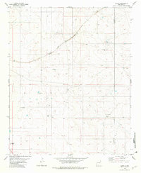
1981 Map of Duoro
USGS Topo · Published 1982About this map
The Atchison Topeka and Santa Fe railroad cuts a diagonal path through this arid high-desert landscape, creating a lifeline through the ranchlands of eastern New Mexico. This 1981 survey reveals a territory where survival and settlement are dictated by water access, marked by a network of family and descriptive landmarks such as Loma Alta Well, Heifer Pasture Well, and Rock Tank Well. The small settlement of Duoro sits along the tracks, serving as a remote outpost in a region primarily defined by expansive grazing operations like Byrd Ranch. The map also captures the political geography of the area, illustrating the boundary between Guadalupe Co and De Baca Co. Topographic details and scattered infrastructure, including a Drill Hole and several storage tanks, suggest the persistent efforts to harness the subsurface resources of this high-plateau environment.
Find a feature on this map
13 named features on this map. Tap any name to fly to it.
Don’t see what you’re looking for? This feature index may not catch every label — zoom into the map to look around manually.
Map Details
Editions of this 1981 Duoro Map
This is the sole edition of this map. No revisions or reprints were ever made.
Other maps of this area

1954 · Fort Sumner
USGS Topo · 1:250,000

1958 · Fort Sumner
USGS Topo · 1:250,000

1978 · El Morro Ranch SE
USGS Topo · 1:24,000

1978 · El Morro Ranch
USGS Topo · 1:24,000

1978 · Long Draw
USGS Topo · 1:24,000

1979 · Fort Sumner
USGS Topo · 1:100,000

1980 · Corona
USGS Topo · 1:100,000

1981 · Loco Draw
USGS Topo · 1:24,000

1981 · Gacho Hill SE
USGS Topo · 1:24,000

1981 · Yeso Mesa
USGS Topo · 1:24,000