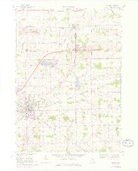
1969 Map of Durand
USGS Topo · Published 1976About this map
The Grand Trunk Western railroad forms a major junction in the city of Durand, reflecting the town's historical significance as a Michigan rail hub during the mid-20th century. This 1969 survey, updated with purple photorevisions from 1975, tracks the evolution of the landscape between Shiawassee and Genesee Counties, where agriculture meets expanding suburban development. Significant local landmarks include the Neal Sch, Pilgrim Ch, and several rural burial grounds such as Yerian Cem and St Joseph Cem. The presence of Leisure Lake and the Sewage Disposal Pond near the city center indicates shifting land use as industrial and residential footprints grew. Waterways like Rush Creek and Misteguay Creek drain the surrounding townships of Venice and Clayton, which remain characterized by a dense grid of country roads including Juddville Road and Grand Blanc Road.
Find a feature on this map
48 named features on this map. Tap any name to fly to it.
Don’t see what you’re looking for? This feature index may not catch every label — zoom into the map to look around manually.
Map Details
Editions of this 1969 Durand Map
2 editions found
Other maps of this area

1917 · Chesaning
USGS Topo · 1:62,500

1919 · Burt
USGS Topo · 1:62,500

1921 · Burt
USGS Topo · 1:62,500

1922 · Durand
USGS Topo · 1:62,500

1926 · Corunna
USGS Topo · 1:62,500

1929 · Corunna
USGS Topo · 1:62,500

1943 · Burt
USGS Topo · 1:62,500

1943 · Chesaning
USGS Topo · 1:62,500

1943 · Durand
USGS Topo · 1:62,500

1944 · Corunna
USGS Topo · 1:62,500