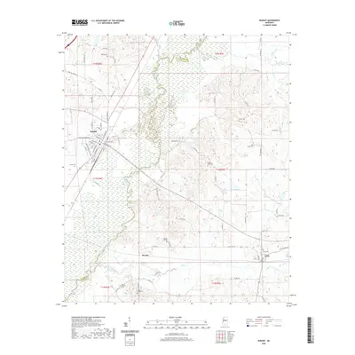
2020 Map of Durant
USGS Topo · Published 2020About this map
The Big Black River snakes through the center of this landscape, defining the boundary between Holmes and Attala counties. The settlement of Durant occupies the northwest, where a structured grid of streets including N Jackson St and W Madison St meets the marshy lowlands surrounding Round Lake. To the southeast, the smaller community of Sallis sits along the southern hills near the headwaters of Long Cr.
Find a feature on this map
78 named features on this map. Tap any name to fly to it.
Don’t see what you’re looking for? This feature index may not catch every label — zoom into the map to look around manually.
Map Details
Editions of this 2020 Durant Map
This is the sole edition of this map. No revisions or reprints were ever made.
Other maps of this area

1953 · Meridian
USGS Topo · 1:250,000

1953 · West Point
USGS Topo · 1:250,000

1957 · Meridian
USGS Topo · 1:250,000

1958 · West Point
USGS Topo · 1:250,000

1962 · Thomastown
USGS Topo · 1:62,500

1963 · West Point
USGS Topo · 1:250,000

1964 · West
USGS Topo · 1:24,000
1964 · Bowling Green
USGS Topo · 1:24,000

1964 · Hesterville
USGS Topo · 1:24,000

1964 · Newport
USGS Topo · 1:24,000