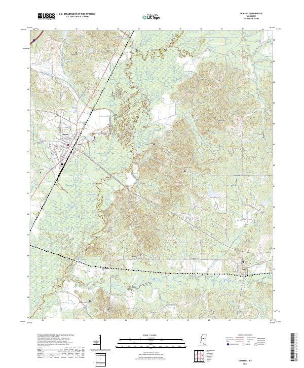
2024 Map of Durant
USGS Topo · Published 2024About this map
The Big Black River carves a meandering path through this central Mississippi landscape, defining the boundary between Holmes County and Attala County. The city of Durant serves as the primary hub, showing a traditional street grid with names like W Madison St, E Mulberry St, and Martin Luther King Jr Dr. Further southeast, the smaller community of Sallis sits along the local rail line, surrounded by the headwaters of Long Creek and Sharkey Creek. This 2024 survey captures a region where family and community history are anchored by numerous rural burial grounds, including Melton Cem, Holeman Cem, and Stump Ridge Cem. The presence of Round Lake and the various tributaries like Indian Creek and Howard Creek highlights the complex hydrology that historically shaped local agriculture and settlement patterns.
Find a feature on this map
77 named features on this map. Tap any name to fly to it.
Don’t see what you’re looking for? This feature index may not catch every label — zoom into the map to look around manually.
Map Details
Editions of this 2024 Durant Map
This is the sole edition of this map. No revisions or reprints were ever made.
Other maps of this area

1953 · Meridian
USGS Topo · 1:250,000

1953 · West Point
USGS Topo · 1:250,000

1957 · Meridian
USGS Topo · 1:250,000

1958 · West Point
USGS Topo · 1:250,000

1962 · Thomastown
USGS Topo · 1:62,500

1963 · West Point
USGS Topo · 1:250,000

1964 · West
USGS Topo · 1:24,000
1964 · Bowling Green
USGS Topo · 1:24,000

1964 · Hesterville
USGS Topo · 1:24,000

1964 · Newport
USGS Topo · 1:24,000