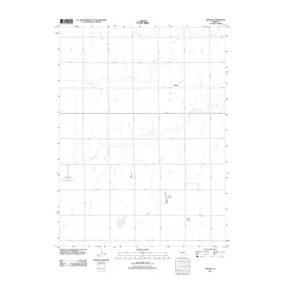
2011 Map of Durant
USGS Topo · Published 2011About this map
Prairie Creek and the Big Blue River meander through this agricultural landscape in Polk County, defining the drainage patterns of the Great Plains during the early 21st century. The settlement of Durant appears as a small node within a rigid section-line road grid, characteristic of the region's homesteading history. While large-scale agricultural operations like Wright's Feedyard indicate the modern industrial scale of cattle ranching, the presence of the Pleasant Hill Cemetery in the southern portion of the map provides a vital link for genealogists researching the area's early settlers. Water management is a visible priority on this prairie terrain, evidenced by the Bjerrum Reservoir and its associated Bjerrum Dam, which together create a localized catchment system in an otherwise stream-fed environment.
Find a feature on this map
27 named features on this map. Tap any name to fly to it.
Don’t see what you’re looking for? This feature index may not catch every label — zoom into the map to look around manually.
Map Details
Editions of this 2011 Durant Map
This is the sole edition of this map. No revisions or reprints were ever made.
Other maps of this area

1896 · Stromsburg
USGS Topo · 1:125,000

1898 · York
USGS Topo · 1:125,000

1899 · York
USGS Topo · 1:125,000

1955 · Fremont
USGS Topo · 1:250,000

1955 · Lincoln
USGS Topo · 1:250,000

1957 · Fremont
USGS Topo · 1:250,000

1957 · Lincoln
USGS Topo · 1:250,000

1958 · Fremont
USGS Topo · 1:250,000

1958 · Lincoln
USGS Topo · 1:250,000

1962 · Polk
USGS Topo · 1:24,000