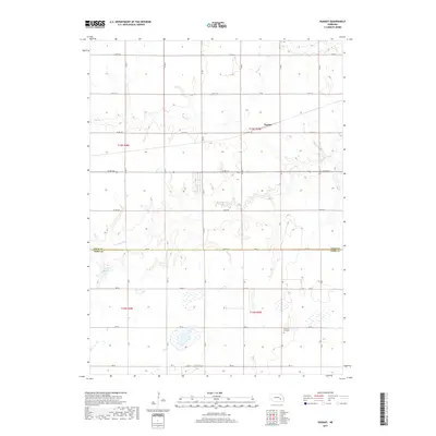
2017 Map of Durant
USGS Topo · Published 2017About this map
The Big Blue River winds through this section of the Nebraska plains, creating a riparian corridor that contrasts with the surrounding agricultural grid. In the north, Durant sits at a junction of section-line roads, representing the small-scale rural settlements that anchored the farming community. The landscape is defined by the Public Land Survey System, with roads like Co RD 124 and Co RD 126 following the rigid township and range lines. Along the southern boundary between Polk and York Counties, the topography becomes more complex where the river and its tributaries, including Prairie Cr, have carved low-lying drainage patterns into the high plains. Local history is anchored by sites such as the Pleasant Hill Cem and the Bjerrum Reservoir, which highlight the importance of water management and community gathering points in this rural environment.
Find a feature on this map
22 named features on this map. Tap any name to fly to it.
Don’t see what you’re looking for? This feature index may not catch every label — zoom into the map to look around manually.
Map Details
Editions of this 2017 Durant Map
This is the sole edition of this map. No revisions or reprints were ever made.
Other maps of this area

1896 · Stromsburg
USGS Topo · 1:125,000

1898 · York
USGS Topo · 1:125,000

1899 · York
USGS Topo · 1:125,000

1955 · Fremont
USGS Topo · 1:250,000

1955 · Lincoln
USGS Topo · 1:250,000

1957 · Fremont
USGS Topo · 1:250,000

1957 · Lincoln
USGS Topo · 1:250,000

1958 · Fremont
USGS Topo · 1:250,000

1958 · Lincoln
USGS Topo · 1:250,000

1962 · Polk
USGS Topo · 1:24,000