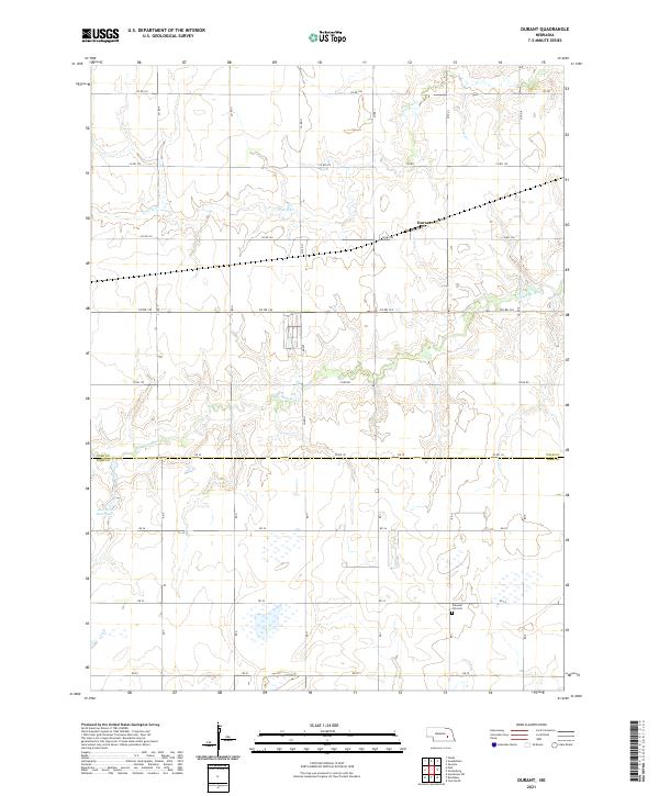
2021 Map of Durant
USGS Topo · Published 2021About this map
The Big Blue River meanders across this Polk County landscape, carving a distinct valley through the agricultural grid of south-central Nebraska. Centered near the settlement of Durant, the map illustrates a region defined by its watercourses and rural infrastructure at the start of the 2020s. In the north, Prairie Cr flows eastward, while the southern portion of the quadrangle transition into York County along RD 25.
Find a feature on this map
28 named features on this map. Tap any name to fly to it.
Don’t see what you’re looking for? This feature index may not catch every label — zoom into the map to look around manually.
Map Details
Editions of this 2021 Durant Map
This is the sole edition of this map. No revisions or reprints were ever made.
Other maps of this area

1896 · Stromsburg
USGS Topo · 1:125,000

1898 · York
USGS Topo · 1:125,000

1899 · York
USGS Topo · 1:125,000

1955 · Fremont
USGS Topo · 1:250,000

1955 · Lincoln
USGS Topo · 1:250,000

1957 · Fremont
USGS Topo · 1:250,000

1957 · Lincoln
USGS Topo · 1:250,000

1958 · Fremont
USGS Topo · 1:250,000

1958 · Lincoln
USGS Topo · 1:250,000

1962 · Polk
USGS Topo · 1:24,000