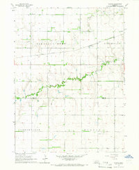
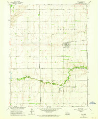
1965 Map of Durant
USGS Topo · Published 1966About this map
Durant serves as the focal point of this mid-1960s agricultural survey, situated along the Union Pacific rail line. The landscape is defined by the winding course of the Big Blue River and Prairie Creek, which drain the surrounding plains. The map records the rural townships of Pleasant Home, Strom Sburg, Arborville, and Morton, revealing a highly organized system of section-line roads and irrigation wells typical of Nebraska's farming heartland. Cultural landmarks such as the Pleasant Hill Cem and a local Substation provide touchstones for local history and genealogy. The boundary between Polk and York counties is clearly delineated, illustrating the administrative divisions of this prairie region before later modernization.
Find a feature on this map
12 named features on this map. Tap any name to fly to it.
Don’t see what you’re looking for? This feature index may not catch every label — zoom into the map to look around manually.
Map Details
Editions of this 1965 Durant Map
This is the sole edition of this map. No revisions or reprints were ever made.
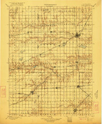
Other maps of this area

1896 · Stromsburg
USGS Topo · 1:125,000

1898 · York
USGS Topo · 1:125,000
1899 · York
USGS Topo · 1:125,000

1955 · Fremont
USGS Topo · 1:250,000

1955 · Lincoln
USGS Topo · 1:250,000

1957 · Fremont
USGS Topo · 1:250,000

1957 · Lincoln
USGS Topo · 1:250,000

1958 · Fremont
USGS Topo · 1:250,000

1958 · Lincoln
USGS Topo · 1:250,000
1962 · Polk
USGS Topo · 1:24,000