
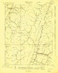
1922 Map of Durbin
USGS Topo · Published 1922About this map
Durbin and Huttonsville anchor this early 1920s survey of the high mountain gaps where the Tygart River and the Shaver Fork drain the highlands of the Monongahela National Forest. The landscape is defined by its early transport arteries, specifically the historic Staunton and Parkersburg Pike and the Western Maryland RR, which facilitated the region's timber and rail economy. This era shows a dense network of local institutions essential to remote mountain life, featuring numerous rural schools such as Lee Bell School, Rosenkrantz School, and the Swecker Ridge School.
Find a feature on this map
67 named features on this map. Tap any name to fly to it.
Don’t see what you’re looking for? This feature index may not catch every label — zoom into the map to look around manually.
Map Details
Editions of this 1922 Durbin Map
4 editions found
Other maps of this area

1889 · Beverly
USGS Topo · 1:125,000

1891 · Huntersville
USGS Topo · 1:125,000

1892 · Beverly
USGS Topo · 1:125,000

1893 · Buckhannon
USGS Topo · 1:125,000

1894 · Huntersville
USGS Topo · 1:125,000

1896 · Buckhannon
USGS Topo · 1:125,000

1897 · Buckhannon
USGS Topo · 1:125,000

1901 · Monterey
USGS Topo · 1:125,000

1909 · Elkins
USGS Topo · 1:62,500

1912 · Sago
USGS Topo · 1:48,000