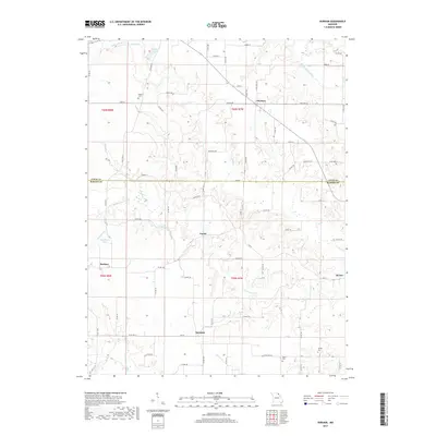
2017 Map of Durham
USGS Topo · Published 2017About this map
Durham and the surrounding agricultural landscapes of the Lewis and Marion county border are defined by the winding paths of the Middle Fabius River and South Fabius River. This rural Missouri terrain in the late 2010s remains punctuated by historic hamlets and family-associated landmarks, including Naomi and Emerson. The map reveals a network of small settlements and rural intersections like Benbow and Hester that have long served as local anchors. Genealogists can locate several burial grounds preserved in the countryside, such as McPike Cem, Wagner Cem, and Banks Cem, which sit alongside drainage features like Troublesome Creek and Pigeon Cr. The landscape is a study in Midwestern water management and local connectivity, where state highways like State Hwy AA and State Hwy M bridge the gaps between scattered farmsteads and the various branches of the Fabius river system.
Find a feature on this map
58 named features on this map. Tap any name to fly to it.
Don’t see what you’re looking for? This feature index may not catch every label — zoom into the map to look around manually.
Map Details
Editions of this 2017 Durham Map
This is the sole edition of this map. No revisions or reprints were ever made.
Other maps of this area

1903 · Kahoka
USGS Topo · 1:125,000

1903 · Palmyra
USGS Topo · 1:125,000

1948 · Quincy
USGS Topo · 1:250,000

1949 · Durham
USGS Topo · 1:24,000

1949 · Maywood
USGS Topo · 1:24,000

1949 · Palmyra
USGS Topo · 1:24,000

1949 · Philadelphia
USGS Topo · 1:24,000
1950 · Maywood
USGS Topo · 1:24,000

1950 · Durham
USGS Topo · 1:24,000

1950 · Palmyra
USGS Topo · 1:24,000