
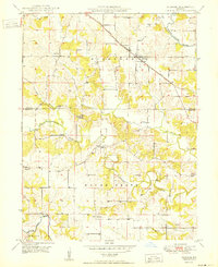
1950 Map of Durham
USGS Topo · Published 1950About this map
Durham serves as a focal point in the northeast corner of this mid-century survey, situated along the Chicago Burlington and Quincy railroad line. The landscape is defined by the drainage basins of the Middle Fabius River and the South Fabius River, with Troublesome Creek winding through the central township of Round Grove. This area on the Lewis and Marion County border is characterized by small, dispersed rural settlements and agricultural infrastructure, including the communities of Emerson, Benbow, and Naomi. Genealogists will find several family and community landmarks, such as Wagner Cem, Banks Cem, and the Mount Sinai Ch. The distribution of these churches and cemeteries reflects the early 20th-century settlement patterns of northeast Missouri, where social life was anchored by local congregations and crossroads post offices like Hester.
Find a feature on this map
20 named features on this map. Tap any name to fly to it.
Don’t see what you’re looking for? This feature index may not catch every label — zoom into the map to look around manually.
Map Details
Editions of this 1950 Durham Map
2 editions found
Other maps of this area

1903 · Kahoka
USGS Topo · 1:125,000

1903 · Palmyra
USGS Topo · 1:125,000

1948 · Quincy
USGS Topo · 1:250,000

1949 · Durham
USGS Topo · 1:24,000

1949 · Maywood
USGS Topo · 1:24,000

1949 · Palmyra
USGS Topo · 1:24,000

1949 · Philadelphia
USGS Topo · 1:24,000
1950 · Maywood
USGS Topo · 1:24,000

1950 · Palmyra
USGS Topo · 1:24,000

1950 · Philadelphia
USGS Topo · 1:24,000