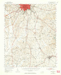
1951 Map of Durham South
USGS Topo · Published 1964About this map
Durham dominates the northern edge of this Piedmont landscape, appearing just as the mid-century suburban expansion began to reshape the surrounding tobacco and timber lands. The sheet captures the critical infrastructure of the era, including the expanding Raleigh-Durham Airport and the complex intersection of the Southern and Seaboard Air Line railroads. Beyond the city limits, the terrain is defined by a dense network of country churches and schools that served rural communities like Morrisville, Cary, and Green Level.
Find a feature on this map
99 named features on this map. Tap any name to fly to it.
Don’t see what you’re looking for? This feature index may not catch every label — zoom into the map to look around manually.
Map Details
Editions of this 1951 Durham South Map
Other maps of this area

1943 · Durham South
USGS Topo · 1:62,500

1943 · Raleigh
USGS Topo · 1:62,500

1943 · Creedmoor
USGS Topo · 1:62,500

1944 · Creedmoor
USGS Topo · 1:62,500

1946 · Chapel Hill
USGS Topo · 1:24,000

1947 · Chapel Hill
USGS Topo · 1:31,680

1951 · Raleigh
USGS Topo · 1:62,500

1951 · Farrington
USGS Topo · 1:24,000

1951 · Durham South
USGS Topo · 1:62,500

1951 · Durham North
USGS Topo · 1:62,500