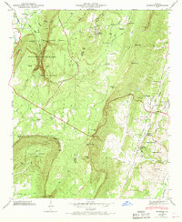
1946 Map of Durham
USGS Topo · Published 1968About this map
Lookout Mountain dominates this landscape, forming a high plateau that drops sharply into the Chattanooga Valley to the east. The 1946 field examination captures the area as the Cloudland Canyon State Park was establishing itself around the dramatic geography of Sutton Gulch and Case Cavern. Industry and transport are centered on the Tennessee Alabama and Georgia RR, which skirts the eastern ridge base, connecting settlements like Cassandra and Cooper Heights.
Find a feature on this map
67 named features on this map. Tap any name to fly to it.
Don’t see what you’re looking for? This feature index may not catch every label — zoom into the map to look around manually.
Map Details
Editions of this 1946 Durham Map
3 editions found
Other maps of this area

1886 · Ringgold
USGS Topo · 1:125,000

1886 · Stevenson
USGS Topo · 1:125,000

1892 · Ringgold
USGS Topo · 1:125,000

1892 · Stevenson
USGS Topo · 1:125,000

1895 · Stevenson
USGS Topo · 1:125,000

1935 · Durham
USGS Topo · 1:24,000

1936 · Trenton
USGS Topo · 1:24,000

1936 · Shellmound
USGS Topo · 1:24,000

1936 · Kensington
USGS Topo · 1:24,000

1936 · Hooker
USGS Topo · 1:24,000