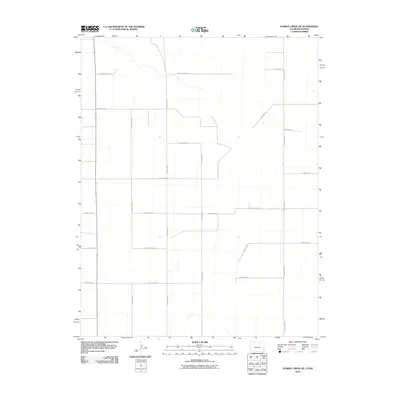
2010 Map of Durkee Creek NE
USGS Topo · Published 2010About this map
The High Plains landscape of Prowers County, Colorado, is defined by the rigid geometry of its section-line road network in this 2010 survey. This area, dominated by agricultural land use, shows the intersection of the primary north-south artery County Road B and its numerous east-west feeders. The infrastructure reflected in routes like County Road AA and County Road Z follows the Public Land Survey System precisely, carving the terrain into predictable squares for farming and ranching. These local routes, including County Rd 37 and County Rd 38, provide the essential connectivity for this rural expanse near the Kansas border, where few natural landmarks break the horizon.
Find a feature on this map
17 named features on this map. Tap any name to fly to it.
Don’t see what you’re looking for? This feature index may not catch every label — zoom into the map to look around manually.
Map Details
Editions of this 2010 Durkee Creek NE Map
This is the sole edition of this map. No revisions or reprints were ever made.
Other maps of this area

1890 · Granada
USGS Topo · 1:125,000

1891 · Albany
USGS Topo · 1:125,000

1892 · Granada
USGS Topo · 1:125,000

1893 · Albany
USGS Topo · 1:125,000

1894 · Granada
USGS Topo · 1:125,000

1900 · Syracuse
USGS Topo · 1:125,000

1920 · Syracuse
USGS Topo · 1:125,000

1953 · Holly West
USGS Topo · 1:24,000

1953 · Holly East
USGS Topo · 1:24,000

1954 · Lamar
USGS Topo · 1:250,000