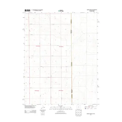
2013 Map of Durkee Creek NE
USGS Topo · Published 2013About this map
The high plains borderland between Colorado and Kansas is defined here by a precise grid of rural infrastructure and administrative boundaries. This 2013 survey documents the intersection of Prowers County and Hamilton County, where the land is divided into the large townships of t024s r042w, t024s r041w, and t025s r042w. The landscape is a textbook example of the Public Land Survey System, characterized by a series of straight-line arterial routes such as Co Road AA, Co Road Y, and Co Road V that follow section lines across the open terrain. The lack of concentrated settlements or named water bodies emphasizes the agricultural character of this remote region, where the primary human features are the very roads that facilitate movement between distant farmsteads and county lines.
Find a feature on this map
16 named features on this map. Tap any name to fly to it.
Don’t see what you’re looking for? This feature index may not catch every label — zoom into the map to look around manually.
Map Details
Editions of this 2013 Durkee Creek NE Map
This is the sole edition of this map. No revisions or reprints were ever made.
Other maps of this area

1890 · Granada
USGS Topo · 1:125,000

1891 · Albany
USGS Topo · 1:125,000

1892 · Granada
USGS Topo · 1:125,000

1893 · Albany
USGS Topo · 1:125,000

1894 · Granada
USGS Topo · 1:125,000

1900 · Syracuse
USGS Topo · 1:125,000

1920 · Syracuse
USGS Topo · 1:125,000

1953 · Holly West
USGS Topo · 1:24,000

1953 · Holly East
USGS Topo · 1:24,000

1954 · Lamar
USGS Topo · 1:250,000