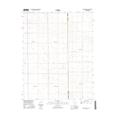
2016 Map of Durkee Creek NE
USGS Topo · Published 2016About this map
The borderlands of Colorado and Kansas meet in this topographic study, where the High Plains landscape is defined by the Public Land Survey System. The transition between Prowers County, Colorado, and Hamilton County, Kansas, is marked by a strict grid of section lines and gravel routes. Major thoroughfares such as Co Rd 37 and Coolidge Rd traverse the open terrain, providing access to the vast ranching and agricultural tracts that characterize the region. While the map is devoid of concentrated settlements, the network of rural roads including Co Rd AA, Co Rd W, and Rd 27 illustrates the persistent human presence required to manage these extensive western lands. The detailed contour lines reveal the subtle drainage patterns that eventually feed into larger regional watersheds, an essential element for understanding the historical development of these plains.
Find a feature on this map
23 named features on this map. Tap any name to fly to it.
Don’t see what you’re looking for? This feature index may not catch every label — zoom into the map to look around manually.
Map Details
Editions of this 2016 Durkee Creek NE Map
This is the sole edition of this map. No revisions or reprints were ever made.
Other maps of this area

1890 · Granada
USGS Topo · 1:125,000

1891 · Albany
USGS Topo · 1:125,000

1892 · Granada
USGS Topo · 1:125,000

1893 · Albany
USGS Topo · 1:125,000

1894 · Granada
USGS Topo · 1:125,000

1900 · Syracuse
USGS Topo · 1:125,000

1920 · Syracuse
USGS Topo · 1:125,000

1953 · Holly West
USGS Topo · 1:24,000

1953 · Holly East
USGS Topo · 1:24,000

1954 · Lamar
USGS Topo · 1:250,000