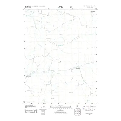
2011 Map of Durst Mountain
USGS Topo · Published 2011About this map
Durst Mountain anchors this topographical survey of Weber County, Utah, where several significant peaks and water systems converge. The terrain is defined by the high elevations of Big Mahogany Mountain and Little Mahogany Mountain to the south, while Elk Mountain dominates the central landscape. This area is a critical watershed for the region, with the North Branch and South Branch South Fork Ogden River flowing through the northwest.
Find a feature on this map
33 named features on this map. Tap any name to fly to it.
Don’t see what you’re looking for? This feature index may not catch every label — zoom into the map to look around manually.
Map Details
Editions of this 2011 Durst Mountain Map
This is the sole edition of this map. No revisions or reprints were ever made.
Other maps of this area

1954 · Ogden
USGS Topo · 1:250,000

1955 · Peterson
USGS Topo · 1:24,000

1955 · Huntsville
USGS Topo · 1:24,000

1955 · Snow Basin
USGS Topo · 1:24,000

1958 · Ogden
USGS Topo · 1:250,000

1960 · Ogden
USGS Topo · 1:250,000
1961 · Devils Slide
USGS Topo · 1:24,000
1961 · Morgan
USGS Topo · 1:24,000

1961 · Morgan
USGS Topo · 1:62,500
1964 · Browns Hole
USGS Topo · 1:24,000