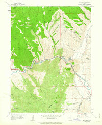
1961 Map of Devils Slide
USGS Topo · Published 1963About this map
Industrial activity and historical western migration routes intersect along the Weber River in this early 1960s survey. The landscape is dominated by the steep walls of Upper Weber Canyon, where the Union Pacific railroad tracks hug the riverbank alongside the Devils Slide Mine and a prominent Cement Plant. These features highlight the importance of the canyon as a critical transportation and resource corridor for Morgan and Summit counties.
Find a feature on this map
53 named features on this map. Tap any name to fly to it.
Don’t see what you’re looking for? This feature index may not catch every label — zoom into the map to look around manually.
Map Details
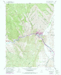
Editions of this 1961 Devils Slide Map
2 editions found
Other maps of this area

1885 · Salt Lake
USGS Topo · 1:250,000

1900 · Coalville
USGS Topo · 1:125,000

1903 · Coalville
USGS Topo · 1:125,000

1925 · Ft. Douglas
USGS Topo · 1:125,000

1928 · Ft. Douglas
USGS Topo · 1:125,000

1954 · Salt Lake City
USGS Topo · 1:250,000

1954 · Ogden
USGS Topo · 1:250,000

1958 · Ogden
USGS Topo · 1:250,000

1958 · Salt Lake City
USGS Topo · 1:250,000

1960 · Ogden
USGS Topo · 1:250,000