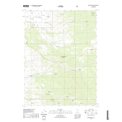
2020 Map of Durst Mountain
USGS Topo · Published 2020About this map
Ogden Valley anchors the northern reach of this landscape, where the Abbey of the Holy Trinity Cem sits near the winding S Br S Fork Ogden River. Much of the territory is defined by the high, wooded slopes of the Cache National Forest, a terrain of steep canyons and high ridges that divide Weber and Morgan counties. The map traces a complex network of drainages and peaks, from the heights of Durst Mtn and Big Mahogany Mtn down through deep cuts like Stoddard Canyon and Arbuckle Canyon.
Find a feature on this map
48 named features on this map. Tap any name to fly to it.
Don’t see what you’re looking for? This feature index may not catch every label — zoom into the map to look around manually.
Map Details
Editions of this 2020 Durst Mountain Map
This is the sole edition of this map. No revisions or reprints were ever made.
Other maps of this area

1954 · Ogden
USGS Topo · 1:250,000

1955 · Peterson
USGS Topo · 1:24,000

1955 · Huntsville
USGS Topo · 1:24,000

1955 · Snow Basin
USGS Topo · 1:24,000

1958 · Ogden
USGS Topo · 1:250,000

1960 · Ogden
USGS Topo · 1:250,000
1961 · Devils Slide
USGS Topo · 1:24,000
1961 · Morgan
USGS Topo · 1:24,000

1961 · Morgan
USGS Topo · 1:62,500
1964 · Browns Hole
USGS Topo · 1:24,000