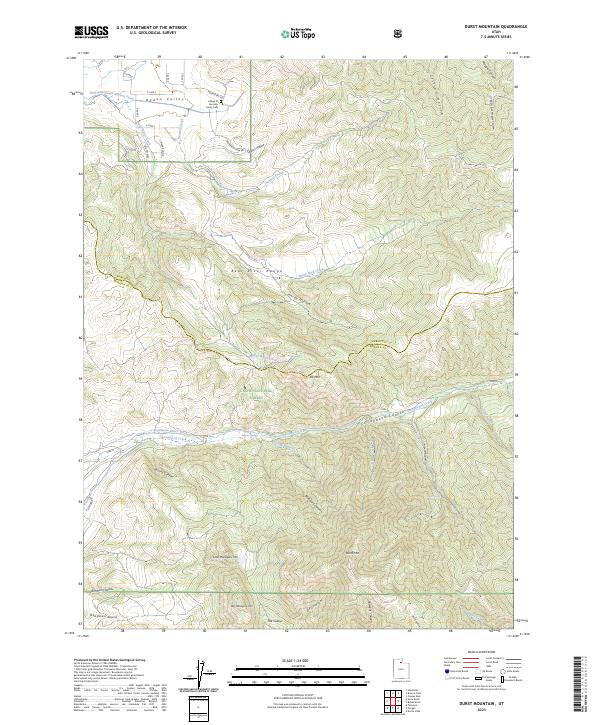
2023 Map of Durst Mountain
USGS Topo · Published 2023About this map
Ogden Valley occupies the northwest corner of this landscape, where the historic Abbey of the Holy Trinity Cem sits near the base of the Bear River Range. The terrain transitions rapidly from the valley floor into the high elevations of the Cache National Forest, defined by a series of steep drainages including Cottonwood Canyon, Arbuckle Canyon, and Stoddard Canyon. Water management is a central feature of the lower elevations, evidenced by the Huntsville South Branch Canal and the Northwest Bench Ditch which divert flows from Cottonwood Creek. To the south, the peaks of Elk Mtn, Little Mahogany Mtn, and Durst Mtn dominate the horizon, while naming conventions like Quarry Hollow and Deadman Gulch hint at the area's early industrial and pioneer history.
Find a feature on this map
51 named features on this map. Tap any name to fly to it.
Don’t see what you’re looking for? This feature index may not catch every label — zoom into the map to look around manually.
Map Details
Editions of this 2023 Durst Mountain Map
This is the sole edition of this map. No revisions or reprints were ever made.
Other maps of this area

1954 · Ogden
USGS Topo · 1:250,000

1955 · Peterson
USGS Topo · 1:24,000

1955 · Huntsville
USGS Topo · 1:24,000

1955 · Snow Basin
USGS Topo · 1:24,000

1958 · Ogden
USGS Topo · 1:250,000

1960 · Ogden
USGS Topo · 1:250,000
1961 · Devils Slide
USGS Topo · 1:24,000
1961 · Morgan
USGS Topo · 1:24,000

1961 · Morgan
USGS Topo · 1:62,500
1964 · Browns Hole
USGS Topo · 1:24,000