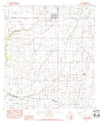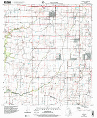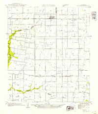
1954 Map of Duson
USGS Topo · Published 1954About this map
The town of Duson serves as a focal point in this mid-century survey of the Acadiana region, situated along the Southern Pacific railroad and US Highway No 90. The landscape is defined by the winding course of the Bayou Queue de Tortue and Bayou de Tortue, which mark the boundary between Acadia and Lafayette parishes. To the south, the settlement of Indian is nestled near the Indian Bayou and the Hunter Irrigation Canal, highlighting the importance of water management in the local agricultural economy.
Find a feature on this map
20 named features on this map. Tap any name to fly to it.
Don’t see what you’re looking for? This feature index may not catch every label — zoom into the map to look around manually.
Map Details
Editions of this 1954 Duson Map
This is the sole edition of this map. No revisions or reprints were ever made.
Historical Maps of Rayne Through Time
9 maps found