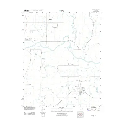
2012 Map of Dustin
USGS Topo · Published 2012About this map
Dustin serves as the primary population center in this portion of Oklahoma, situated just south of the winding N Canadian River. The landscape is defined by its deep ties to the energy industry, with the East Weleetka Oil and Gas Field and the West Dustin Oil Field punctuating the rural sections of the quadrangle. These industrial sites are interspersed among a network of creeks, including Bad Cr, Alabama Cr, and Stidham Cr, which drain the varied terrain.
Find a feature on this map
59 named features on this map. Tap any name to fly to it.
Don’t see what you’re looking for? This feature index may not catch every label — zoom into the map to look around manually.
Map Details
Editions of this 2012 Dustin Map
This is the sole edition of this map. No revisions or reprints were ever made.
Other maps of this area

1900 · Canadian
USGS Topo · 1:125,000

1900 · Wewoka
USGS Topo · 1:125,000

1946 · Fort Smith
USGS Topo · 1:250,000

1954 · Oklahoma City
USGS Topo · 1:250,000

1957 · Oklahoma City
USGS Topo · 1:250,000

1962 · Henryetta
USGS Topo · 1:24,000

1962 · Henryetta SW
USGS Topo · 1:24,000

1963 · Oklahoma City
USGS Topo · 1:250,000

1965 · Fort Smith
USGS Topo · 1:250,000

1967 · Fort Smith
USGS Topo · 1:250,000