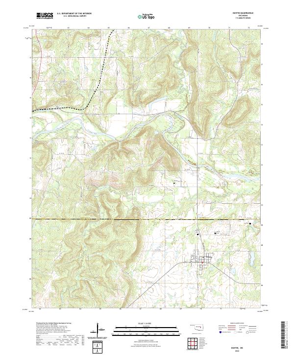
2022 Map of Dustin
USGS Topo · Published 2022About this map
The Dustin settlement serves as the focal point for this survey along the border of Okfuskee Co and Hughes Co. The landscape is dominated by the meandering course of the North Canadian River, which is fed by numerous tributaries including Alabama Creek, Stidham Cr, and Bad Creek. These waterways and their associated valleys likely dictated the placement of early homesteads and cemeteries that dot the area. Local history is particularly evident in the presence of several burial sites, such as the Old Dustin Cem and the Dustin Cem located just north of the town center. The map reveals a transition from the structured street grid of the town, featuring Sparks St, to a rural network of section-line roads like E 120 Rd and N 393 Rd, illustrating the intersection of residential life and the surrounding agricultural environment.
Find a feature on this map
58 named features on this map. Tap any name to fly to it.
Don’t see what you’re looking for? This feature index may not catch every label — zoom into the map to look around manually.
Map Details
Editions of this 2022 Dustin Map
This is the sole edition of this map. No revisions or reprints were ever made.
Other maps of this area

1900 · Canadian
USGS Topo · 1:125,000

1900 · Wewoka
USGS Topo · 1:125,000

1946 · Fort Smith
USGS Topo · 1:250,000

1954 · Oklahoma City
USGS Topo · 1:250,000

1957 · Oklahoma City
USGS Topo · 1:250,000

1962 · Henryetta
USGS Topo · 1:24,000

1962 · Henryetta SW
USGS Topo · 1:24,000

1963 · Oklahoma City
USGS Topo · 1:250,000

1965 · Fort Smith
USGS Topo · 1:250,000

1967 · Fort Smith
USGS Topo · 1:250,000