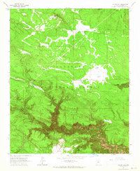
1963 Map of Dutton Hill
USGS Topo · Published 1965About this map
The high plateau of the Coconino National Forest drops sharply into the dramatic drainages of the West Fork Oak Creek in this mid-century topographic survey. The landscape is characterized by a transition from the relatively level volcanic and parkland terrain of Mill Park and Fry Park to the deeply incised canyons of the southern half. Geological features like the Crater Sinks and a prominent Cinder Pit near Yellow Flat highlight the region's volcanic history, while a network of stock tanks—such as Scott Tank and Phone Booth Tank—points to the area's use for cattle ranging. The elevation changes are most extreme along Harding Point and Buzzard Ridge, where the sheer walls of Fry Canyon and Sterling Canyon reveal the complex hydrology of the Howard Pocket region.
Find a feature on this map
38 named features on this map. Tap any name to fly to it.
Don’t see what you’re looking for? This feature index may not catch every label — zoom into the map to look around manually.
Map Details
Editions of this 1963 Dutton Hill Map
4 editions found
Other maps of this area

1886 · San Francisco Mtns
USGS Topo · 1:250,000

1887 · Verde
USGS Topo · 1:250,000

1891 · San Francisco Mtns
USGS Topo · 1:250,000

1892 · Verde
USGS Topo · 1:250,000

1894 · San Francisco Mtns
USGS Topo · 1:250,000

1899 · San Francisco Mtns
USGS Topo · 1:250,000

1908 · Flagstaff
USGS Topo · 1:125,000

1912 · Flagstaff
USGS Topo · 1:125,000

1923 · Camp Verde
USGS Topo · 1:125,000

1932 · Camp Verde
USGS Topo · 1:125,000