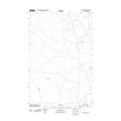
2011 Map of Dutton Ranch
USGS Topo · Published 2011About this map
Dutton Ranch and its surrounding rangeland characterize this portion of Garfield County, Montana, during the early 21st century. The landscape is defined by a dendritic network of seasonal drainages and coulees, reflecting the arid nature of the region. Notable water management features include BN Number 11 Dam and L Galt Number 24 Dam, which likely serve as stock ponds for local ranching operations. The terrain is deeply incised by Sage Hen Creek in the northwest and Fish Creek in the northeast, while the southeastern corner is marked by Atkins Coulee and the winding course of Little Breed Creek. A few isolated landmarks such as Mud Springs and Heinecke Coulee provide essential orientation points in this sparsely populated cattle country.
Find a feature on this map
9 named features on this map. Tap any name to fly to it.
Don’t see what you’re looking for? This feature index may not catch every label — zoom into the map to look around manually.
Map Details
Editions of this 2011 Dutton Ranch Map
This is the sole edition of this map. No revisions or reprints were ever made.
Other maps of this area

1954 · Jordan
USGS Topo · 1:250,000

1954 · Forsyth
USGS Topo · 1:250,000

1956 · Jordan
USGS Topo · 1:250,000

1957 · Forsyth
USGS Topo · 1:250,000

1958 · Jordan
USGS Topo · 1:250,000

1958 · Forsyth
USGS Topo · 1:250,000

1962 · Kincheloe Ranch
USGS Topo · 1:24,000

1962 · Mosby SE
USGS Topo · 1:24,000
1963 · Hill Ranch
USGS Topo · 1:24,000

1963 · Mc Williams Springs
USGS Topo · 1:24,000