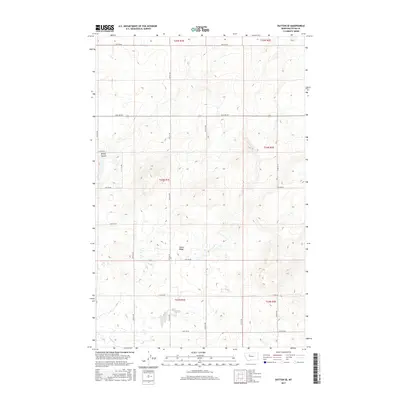
2017 Map of Dutton SE
USGS Topo · Published 2017About this map
Teton Ridge dominates the central landscape of this Teton County quadrangle, where the high plains of Montana are etched by seasonal drainages and a strict grid of section lines. The topography reveals a transition from the elevated benchlands down toward the winding path of Kinley Coulee in the northwest and Lake Cr along the southern edge. This 2017 survey illustrates the enduring rectilinear layout of the American West, where local transit is defined by precisely spaced routes like 18th Rd Ne and 20th Ln Ne. The land remains largely open, reflecting a rural character where water features and subtle elevation changes are the primary landmarks across the township and range divisions of T24N and T23N.
Find a feature on this map
24 named features on this map. Tap any name to fly to it.
Don’t see what you’re looking for? This feature index may not catch every label — zoom into the map to look around manually.
Map Details
Editions of this 2017 Dutton SE Map
This is the sole edition of this map. No revisions or reprints were ever made.
Other maps of this area

1886 · Great Falls
USGS Topo · 1:250,000

1949 · Timber Coulee
USGS Topo · 1:62,500

1949 · Great Falls
USGS Topo · 1:62,500

1949 · Vaughn
USGS Topo · 1:62,500

1950 · Timber Coulee
USGS Topo · 1:62,500

1950 · Dutton
USGS Topo · 1:62,500

1951 · Great Falls
USGS Topo · 1:62,500

1952 · Vaughn
USGS Topo · 1:62,500

1954 · Great Falls
USGS Topo · 1:250,000

1957 · Great Falls
USGS Topo · 1:250,000