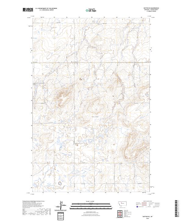
2024 Map of Dutton SE
USGS Topo · Published 2024About this map
Teton Ridge stretches across this landscape, providing a high divide in the agricultural country of Teton County. The terrain is defined by its drainages, with Kinley Coulee cutting into the western slopes and Lake Creek flowing through the southern sections. This area exhibits a precise grid of rural section lines and access ways, including 18th Rd NE and 10th Rd NE, which facilitate movement between large tracts of land. The geography is characteristic of the high plains, where the interplay of subtle elevation changes and watercourses dictates the placement of infrastructure. The lack of concentrated settlements highlights the open, expansive nature of this part of Montana as documented in recent years.
Find a feature on this map
24 named features on this map. Tap any name to fly to it.
Don’t see what you’re looking for? This feature index may not catch every label — zoom into the map to look around manually.
Map Details
Editions of this 2024 Dutton SE Map
This is the sole edition of this map. No revisions or reprints were ever made.
Other maps of this area

1886 · Great Falls
USGS Topo · 1:250,000

1949 · Timber Coulee
USGS Topo · 1:62,500

1949 · Great Falls
USGS Topo · 1:62,500

1949 · Vaughn
USGS Topo · 1:62,500

1950 · Timber Coulee
USGS Topo · 1:62,500

1950 · Dutton
USGS Topo · 1:62,500

1951 · Great Falls
USGS Topo · 1:62,500

1952 · Vaughn
USGS Topo · 1:62,500

1954 · Great Falls
USGS Topo · 1:250,000

1957 · Great Falls
USGS Topo · 1:250,000