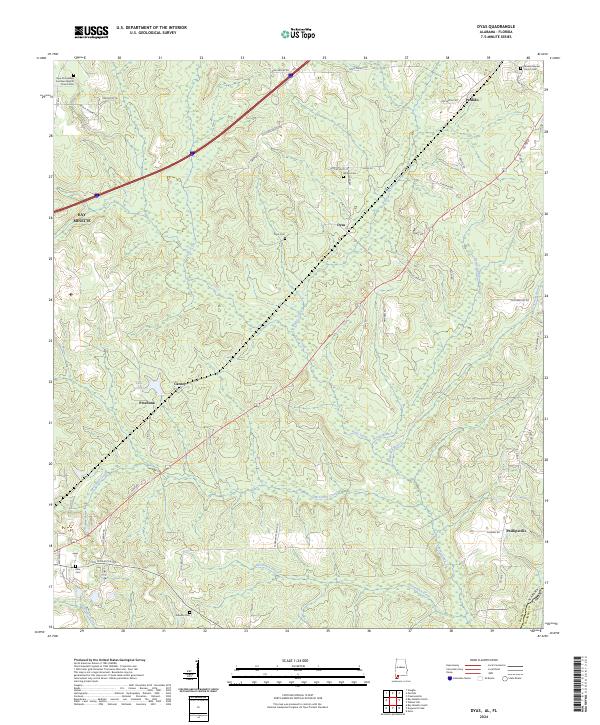
2024 Map of Dyas
USGS Topo · Published 2024About this map
The community of Perdido and the surrounding pine-rich lowlands of Baldwin County define this modern survey at the Alabama-Florida state line. The landscape is shaped by the intricate drainage of Bushy Creek, Dyas Creek, and Horseneck Creek, which wind through the rural townships. Small, historic settlements like Dyas, Carney, and Pinchona are centered around crossroads and family-named routes such as Dan Hadley Rd and Old Carney Rd. Several rural burial grounds, including Dyas Cem, Gideon's Cem, and Whites Cem, are scattered across the quadrangle, serving as vital markers for local genealogists and family historians. To the southwest, Lake Crosby provides a distinct geographic landmark amidst the woodland, while the northeastern corner shows the proximity of the Escambia Co border near Perdido Baptist Church.
Find a feature on this map
64 named features on this map. Tap any name to fly to it.
Don’t see what you’re looking for? This feature index may not catch every label — zoom into the map to look around manually.
Map Details
Editions of this 2024 Dyas Map
This is the sole edition of this map. No revisions or reprints were ever made.
Other maps of this area

1941 · Bay Minette
USGS Topo · 1:62,500

1942 · Perdido
USGS Topo · 1:62,500

1942 · Dyas
USGS Topo · 1:62,500

1943 · Bay Minette
USGS Topo · 1:62,500

1943 · Tensaw
USGS Topo · 1:62,500

1944 · Tensaw
USGS Topo · 1:62,500

1944 · Dyas
USGS Topo · 1:62,500

1944 · Perdido
USGS Topo · 1:62,500

1953 · Andalusia
USGS Topo · 1:250,000

1957 · Andalusia
USGS Topo · 1:250,000