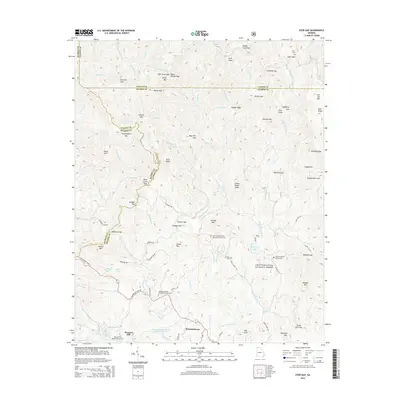
2014 Map of Dyer Gap
USGS Topo · Published 2014About this map
Mountaintown and the surrounding high ridges of the Chattahoochee National Forest define this landscape along the borders of Gilmer, Fannin, and Murray Counties. This 2014 survey captures a rural North Georgia terrain characterized by isolated church cemeteries and a complex network of mountain gaps. Significant local genealogy sites are well-documented, including Gates Chapel United Methodist Church Cem, Zion Hill Baptist Church Cem, and the high-elevation Dyer Cem near Dyer Gap. The headwaters of the Conasauga River and Mountaintown Cr wind through the topography, flanked by prominent features like Potatopatch Mtn and Cohutta Mtn. These ridges are connected by historic pass-throughs such as Alaculsy Gap and Holly Creek Gap, illustrating the traditional movement patterns between these mountain communities.
Find a feature on this map
107 named features on this map. Tap any name to fly to it.
Don’t see what you’re looking for? This feature index may not catch every label — zoom into the map to look around manually.
Map Details
Editions of this 2014 Dyer Gap Map
This is the sole edition of this map. No revisions or reprints were ever made.
Other maps of this area

1886 · Dalton
USGS Topo · 1:125,000

1888 · Ellijay
USGS Topo · 1:125,000

1892 · Ellijay
USGS Topo · 1:125,000

1892 · Dalton
USGS Topo · 1:125,000

1897 · Dalton
USGS Topo · 1:125,000

1898 · Ellijay
USGS Topo · 1:125,000

1911 · Ellijay
USGS Topo · 1:125,000

1911 · Cohutta Mtn
USGS Topo · 1:62,500

1913 · Cohutta Mtn.
USGS Topo · 1:62,500

1914 · Talking Rock
USGS Topo · 1:62,500