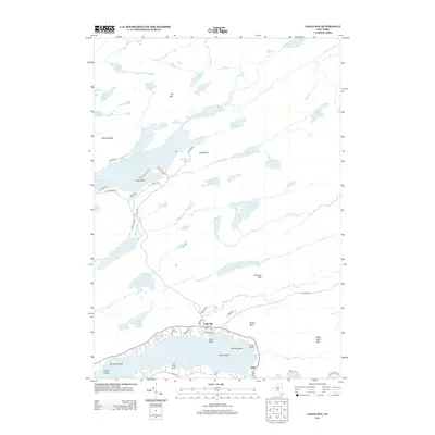
2013 Map of Eagle Bay
USGS Topo · Published 2013About this map
Eagle Bay and Inlet serve as the primary settlement points along the north shore of the Fulton Chain Lakes in this portion of the Adirondacks. The landscape is defined by an intricate network of glacial lakes and mountain peaks, including Big Moose Lake and the smaller Dart Lake to the west. Evidence of early tourism and seasonal residency is visible in the dense road networks around Craig Point and the various points along the waterfront like Eagle Point and Rock Point.
Find a feature on this map
73 named features on this map. Tap any name to fly to it.
Don’t see what you’re looking for? This feature index may not catch every label — zoom into the map to look around manually.
Map Details
Editions of this 2013 Eagle Bay Map
This is the sole edition of this map. No revisions or reprints were ever made.
Other maps of this area

1900 · Canada Lake
USGS Topo · 1:62,500

1901 · Old Forge
USGS Topo · 1:62,500

1903 · Big Moose
USGS Topo · 1:62,500

1903 · West Canada Lakes
USGS Topo · 1:62,500

1903 · Raquette Lake
USGS Topo · 1:62,500

1950 · Utica
USGS Topo · 1:250,000

1954 · Old Forge
USGS Topo · 1:62,500

1954 · West Canada Lakes
USGS Topo · 1:62,500
1954 · Raquette Lake
USGS Topo · 1:62,500

1954 · Big Moose
USGS Topo · 1:62,500