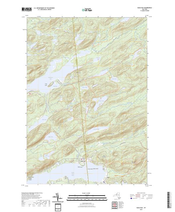
2023 Map of Eagle Bay
USGS Topo · Published 2023About this map
Eagle Bay and Inlet serve as the primary gateways to this pocket of the Adirondacks, where the Fulton Chain Lakes and Big Moose Lake define the lowlands. The landscape is a complex network of glacial ponds and narrow drainage systems, including the South Branch and Eagle Creek, which flow through the shadow of Cascade Mountain and Black Bear Mountain. This modern 2023 survey documents the extensive trail system that facilitates travel through the wooded interior, such as the Windfall Pond-Queer Lake Trl and the Moss-Lake Circuit Trl.
Find a feature on this map
82 named features on this map. Tap any name to fly to it.
Don’t see what you’re looking for? This feature index may not catch every label — zoom into the map to look around manually.
Map Details
Editions of this 2023 Eagle Bay Map
This is the sole edition of this map. No revisions or reprints were ever made.
Other maps of this area

1900 · Canada Lake
USGS Topo · 1:62,500

1901 · Old Forge
USGS Topo · 1:62,500

1903 · Big Moose
USGS Topo · 1:62,500

1903 · West Canada Lakes
USGS Topo · 1:62,500

1903 · Raquette Lake
USGS Topo · 1:62,500

1950 · Utica
USGS Topo · 1:250,000

1954 · Old Forge
USGS Topo · 1:62,500

1954 · West Canada Lakes
USGS Topo · 1:62,500
1954 · Raquette Lake
USGS Topo · 1:62,500

1954 · Big Moose
USGS Topo · 1:62,500