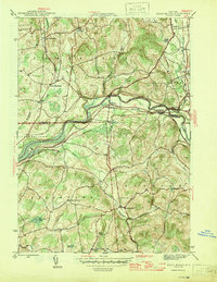
1946 Map of Eagle Bridge
USGS Topo · Published 1946About this map
The Hoosic River valley serves as the central artery for this mid-century landscape, where the Boston and Maine railroad tracks parallel the water to connect rural hamlets across the Washington and Rensselaer county line. The settlement at Eagle Bridge stands as a focal point for the region's transport network, supported by smaller nodes like Buskirk and East Buskirk. To the north, the terrain of Cambridge is dotted with agricultural clusters such as West Cambridge and South Cambridge, while the southern reaches of Pittstown and Hoosick show a more dispersed pattern of hilltop farms and local landmarks like Echo Lake and Woodside Cem. This 1940s survey captures a moment of transition for these upstate New York communities, where established schools like School No 2 and School No 4 remained vital to the rural social structure even as the rail-and-river economy was shifting.
Find a feature on this map
33 named features on this map. Tap any name to fly to it.
Don’t see what you’re looking for? This feature index may not catch every label — zoom into the map to look around manually.
Map Details
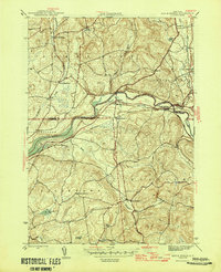
Editions of this 1946 Eagle Bridge Map
2 editions found
Other maps of this area

1893 · Cohoes
USGS Topo · 1:62,500

1895 · Cohoes
USGS Topo · 1:62,500

1895 · Cambridge
USGS Topo · 1:62,500

1897 · Hoosick
USGS Topo · 1:62,500

1898 · Cambridge
USGS Topo · 1:62,500

1898 · Cohoes
USGS Topo · 1:62,500

1900 · Taconic
USGS Topo · 1:125,000

1900 · Schuylerville
USGS Topo · 1:62,500

1901 · Cambridge
USGS Topo · 1:62,500

1903 · Mettawee
USGS Topo · 1:125,000