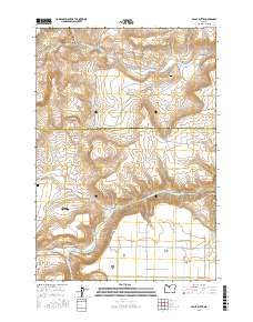
2017 Map of Eagle Butte
USGS Topo · Published 2017About this map
Warm Springs and the surrounding tribal lands define this high-desert landscape where the Warm Springs River meets the Deschutes River. The geography is marked by distinct geological formations and local landmarks such as Eagle Butte and Tee Wees Butte, while the Agency Plains stretch toward the southeast. The map details a network of essential water sources including Shitike Creek and Dry Creek, alongside unique features like the Kah-nee-ta Hot Spring.
Find a feature on this map
52 named features on this map. Tap any name to fly to it.
Don’t see what you’re looking for? This feature index may not catch every label — zoom into the map to look around manually.
Map Details
Editions of this 2017 Eagle Butte Map
This is the sole edition of this map. No revisions or reprints were ever made.
Other maps of this area

1928 · Madras
USGS Topo · 1:125,000

1931 · Madras
USGS Topo · 1:125,000

1955 · Bend
USGS Topo · 1:250,000

1957 · Bend
USGS Topo · 1:250,000

1958 · Bend
USGS Topo · 1:250,000
1962 · Simnasho
USGS Topo · 1:24,000
1962 · Kaskela
USGS Topo · 1:24,000

1962 · Eagle Butte
USGS Topo · 1:24,000
1962 · Seekseequa Junction
USGS Topo · 1:24,000

1962 · Gateway
USGS Topo · 1:24,000