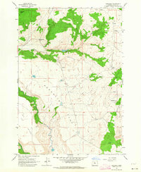
1962 Map of Simnasho
USGS Topo · Published 1964About this map
The settlement of Simnasho serves as a focal point in this high-desert landscape of the Warm Springs Indian Reservation. Recorded during the early 1960s, the terrain is defined by the contrast between the broad expanse of Schoolie Flat and the rising heights of the Mutton Mountains to the east. Water resources are critical markers of survival and habitation here, represented by the Happy Valley Reservoir, the Suppah Windmill, and family-named landmarks such as La Clair Spring. The map documents the local geography before major modern development, showing the winding course of the Warm Springs River along the southern border. Genealogists and historians will find value in the location of the Simnasho Cemetery and several small extractive sites like the Borrow Pit and Quarry, which suggest early infrastructure and land use patterns.
Find a feature on this map
22 named features on this map. Tap any name to fly to it.
Don’t see what you’re looking for? This feature index may not catch every label — zoom into the map to look around manually.
Map Details
Editions of this 1962 Simnasho Map
2 editions found
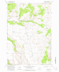
Other maps of this area

1928 · Madras
USGS Topo · 1:125,000

1930 · Dufur
USGS Topo · 1:125,000

1931 · Madras
USGS Topo · 1:125,000

1934 · Dufur
USGS Topo · 1:125,000

1953 · The Dalles
USGS Topo · 1:250,000

1955 · Bend
USGS Topo · 1:250,000

1956 · The Dalles
USGS Topo · 1:250,000

1957 · Bend
USGS Topo · 1:250,000

1957 · The Dalles
USGS Topo · 1:250,000

1958 · Bend
USGS Topo · 1:250,000