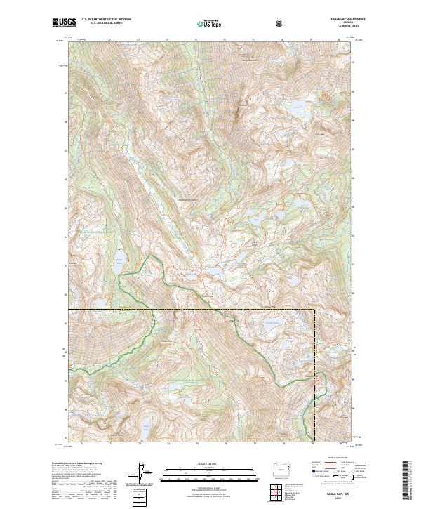
2023 Map of Eagle Cap
USGS Topo · Published 2023About this map
The Wallowa Mountains rise sharply in this high-altitude survey of the Eagle Cap Wilderness, defined by the convergence of several wild and scenic river corridors. The landscape is a network of alpine basins and dramatic peaks, including Sacajawea Peak and the Matterhorn, which overlook the glacial valleys of the Lostine River and Minam River. A complex system of trails, such as the Ivan Carper Trl and Minam Lake Trl, connects high-mountain passes like Horton Pass and Glacier Pass. This area, within both the Wallowa National Forest and Whitman National Forest, serves as a critical watershed where the East Fork Wallowa River and Hurricane Creek originate among dozens of alpine lakes like Mirror Lake and Moccasin Lake.
Find a feature on this map
85 named features on this map. Tap any name to fly to it.
Don’t see what you’re looking for? This feature index may not catch every label — zoom into the map to look around manually.
Map Details
Editions of this 2023 Eagle Cap Map
This is the sole edition of this map. No revisions or reprints were ever made.
Other maps of this area

1954 · Cornucopia
USGS Topo · 1:62,500

1954 · Eagle Cap
USGS Topo · 1:62,500

1955 · Grangeville
USGS Topo · 1:250,000

1957 · Enterprise
USGS Topo · 1:62,500

1957 · Joseph
USGS Topo · 1:62,500

1959 · Grangeville
USGS Topo · 1:250,000

1986 · Enterprise
USGS Topo · 1:100,000
1990 · Krag Peak
USGS Topo · 1:24,000

1990 · Chief Joseph Mtn
USGS Topo · 1:24,000
1990 · Eagle Cap
USGS Topo · 1:24,000