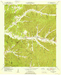
1949 Map of Eagle Creek
USGS Topo · Published 1952About this map
The border of Wayne and Hardin counties is defined by a landscape of intricate hollows and ridges, centered on the drainage basins of Eagle Creek and Hardin Creek. In this mid-century period, the area is characterized by a network of small family cemeteries and remote churches that speak to the local genealogy of the Tennessee Valley. Names like Haggard, Elliott, and Grimes are scattered throughout the wooded terrain, often located near the heads of hollows such as Schote Hollow or Dillion Hollow.
Find a feature on this map
108 named features on this map. Tap any name to fly to it.
Don’t see what you’re looking for? This feature index may not catch every label — zoom into the map to look around manually.
Map Details
Editions of this 1949 Eagle Creek Map
3 editions found
Other maps of this area

1905 · Waynesboro
USGS Topo · 1:125,000

1936 · Wolf Pit Ridge
USGS Topo · 1:24,000

1936 · Eagle Creek
USGS Topo · 1:24,000

1936 · Olivehill
USGS Topo · 1:24,000

1936 · Bath Springs
USGS Topo · 1:24,000

1936 · Leatherwood
USGS Topo · 1:24,000

1936 · Clifton
USGS Topo · 1:24,000

1936 · Three Churches
USGS Topo · 1:24,000

1936 · Waynesboro
USGS Topo · 1:24,000

1936 · Martins Mills
USGS Topo · 1:24,000