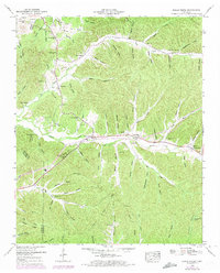
1949 Map of Eagle Creek
USGS Topo · Published 1975About this map
Hardin Creek and Eagle Creek carve through the heavily dissected landscape of the Highland Rim along the Wayne and Hardin County line. This mid-century topography reveals a rural society organized around narrow valleys and countless named hollows, such as Throgmartin Hollow and Hendricks Hollow. The settlement pattern follows the water, with clusters of family history found at Lizard Glade Cem, Blackshire Cem, and Friendship Cem.
Find a feature on this map
71 named features on this map. Tap any name to fly to it.
Don’t see what you’re looking for? This feature index may not catch every label — zoom into the map to look around manually.
Map Details
Editions of this 1949 Eagle Creek Map
3 editions found
Other maps of this area

1905 · Waynesboro
USGS Topo · 1:125,000

1936 · Wolf Pit Ridge
USGS Topo · 1:24,000

1936 · Eagle Creek
USGS Topo · 1:24,000

1936 · Olivehill
USGS Topo · 1:24,000

1936 · Bath Springs
USGS Topo · 1:24,000

1936 · Leatherwood
USGS Topo · 1:24,000

1936 · Clifton
USGS Topo · 1:24,000

1936 · Three Churches
USGS Topo · 1:24,000

1936 · Waynesboro
USGS Topo · 1:24,000

1936 · Martins Mills
USGS Topo · 1:24,000