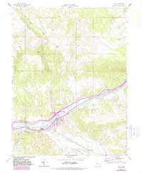
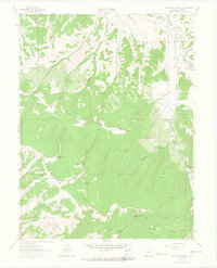
1962 Map of Eagle
USGS Topo · Published 1988About this map
The town of Eagle serves as the focal point of this 1960s landscape, situated where Brush Creek joins the Eagle River. The mapping reveals a complex network of water management essential for high-altitude ranching and settlement, featuring numerous named irrigation systems like the Wilkinson Ditch, Schumm Ditch No 1, and the Hockett Aqueduct. These man-made features weave through the valleys, supporting the valley floor beneath the massive rising profile of Greenhorn Mountain to the northwest.
Find a feature on this map
37 named features on this map. Tap any name to fly to it.
Don’t see what you’re looking for? This feature index may not catch every label — zoom into the map to look around manually.
Map Details
Editions of this 1962 Eagle Map
4 editions found
Other maps of this area

1957 · Leadville
USGS Topo · 1:250,000

1959 · Leadville
USGS Topo · 1:250,000

1960 · Leadville
USGS Topo · 1:250,000

1962 · Leadville
USGS Topo · 1:250,000

1962 · Gypsum
USGS Topo · 1:24,000
1962 · Suicide Mountain
USGS Topo · 1:24,000

1962 · Fulford
USGS Topo · 1:24,000

1962 · Wolcott
USGS Topo · 1:24,000

1962 · Eagle
USGS Topo · 1:24,000
1962 · The Seven Hermits
USGS Topo · 1:24,000