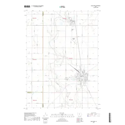
2018 Map of Eagle Grove
USGS Topo · Published 2018About this map
The Boone River meanders through the central corridor of this Wright County landscape, anchoring the settlements of Goldfield to the north and Eagle Grove to the south. The terrain is characterized by an extensive network of managed waterways, such as Ditch Number 4 and Drainage Ditch Number 102, which have historically facilitated the region's agricultural productivity by draining the surrounding plains.
Find a feature on this map
91 named features on this map. Tap any name to fly to it.
Don’t see what you’re looking for? This feature index may not catch every label — zoom into the map to look around manually.
Map Details
Editions of this 2018 Eagle Grove Map
This is the sole edition of this map. No revisions or reprints were ever made.
Other maps of this area

1923 · Fort Dodge
USGS Topo · 1:62,500

1954 · Waterloo
USGS Topo · 1:250,000

1954 · Fort Dodge
USGS Topo · 1:250,000

1955 · Waterloo
USGS Topo · 1:250,000

1957 · Fort Dodge
USGS Topo · 1:250,000

1958 · Fort Dodge
USGS Topo · 1:250,000

1972 · Kanawha SE
USGS Topo · 1:24,000

1972 · Renwick
USGS Topo · 1:24,000
1972 · Hardy
USGS Topo · 1:24,000

1978 · Holmes
USGS Topo · 1:24,000