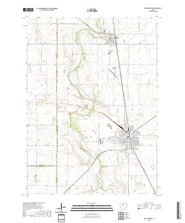
2022 Map of Eagle Grove
USGS Topo · Published 2022About this map
The Boone River meanders through this agricultural landscape at the tri-county junction of Wright, Humboldt, and Webster counties. The area is anchored by the northern settlement of Goldfield and the larger city of Eagle Grove to the southeast. A significant transformation of the prairie is evident in the intricate network of drainage channels, including Ditch Number 4 and Drainage Ditch Number 102, which have long supported the region's intensive farming. Local history is preserved in several burial sites such as the Wright County Burying Grounds and Rose Hill Cem. For those tracing the evolution of regional travel, the Three Rivers Trl follows a former rail corridor across the river valley, while the Eagle Grove Municipal Airport serves as a modern transportation hub north of the city center.
Find a feature on this map
52 named features on this map. Tap any name to fly to it.
Don’t see what you’re looking for? This feature index may not catch every label — zoom into the map to look around manually.
Map Details
Editions of this 2022 Eagle Grove Map
This is the sole edition of this map. No revisions or reprints were ever made.
Other maps of this area

1923 · Fort Dodge
USGS Topo · 1:62,500

1954 · Waterloo
USGS Topo · 1:250,000

1954 · Fort Dodge
USGS Topo · 1:250,000

1955 · Waterloo
USGS Topo · 1:250,000

1957 · Fort Dodge
USGS Topo · 1:250,000

1958 · Fort Dodge
USGS Topo · 1:250,000

1972 · Kanawha SE
USGS Topo · 1:24,000

1972 · Renwick
USGS Topo · 1:24,000
1972 · Hardy
USGS Topo · 1:24,000

1978 · Holmes
USGS Topo · 1:24,000