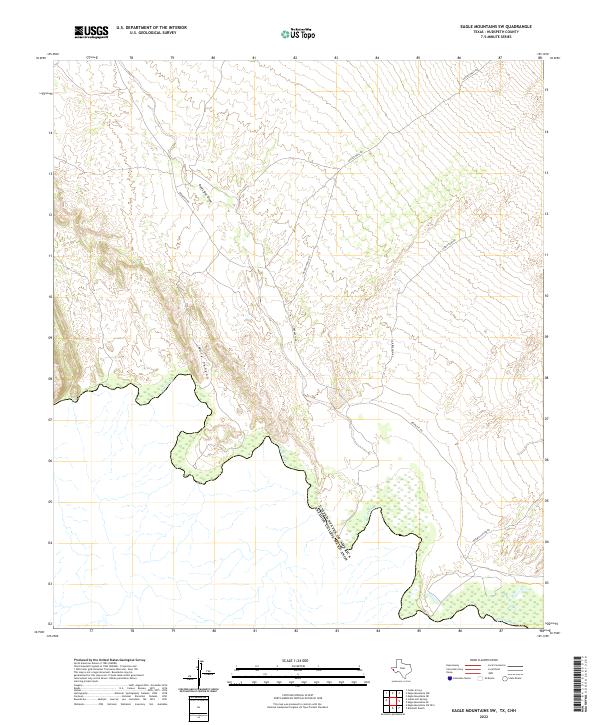
2022 Map of Eagle Mountains SW
USGS Topo · Published 2022About this map
The Rio Grande forms the southern boundary of this Hudspeth County landscape, marking the international border between the United States of America and Mexico. This arid West Texas terrain is defined by dramatic drainage systems, including the prominent Red Light Draw and the deep incisions of Mule Canyon. Unlike many regions, the human footprint here is sparse and functional, centered on a small network of ranch roads such as Bramlett Rd and August Well Rd.
Find a feature on this map
8 named features on this map. Tap any name to fly to it.
Don’t see what you’re looking for? This feature index may not catch every label — zoom into the map to look around manually.
Map Details
Editions of this 2022 Eagle Mountains SW Map
This is the sole edition of this map. No revisions or reprints were ever made.
Other maps of this area

1897 · Eagle Mountain
USGS Topo · 1:125,000

1916 · Eagle Mountain
USGS Topo · 1:125,000

1959 · Marfa
USGS Topo · 1:250,000

1965 · Marfa
USGS Topo · 1:250,000
1972 · Eagle Mountains NW
USGS Topo · 1:24,000
1972 · Bramlett Ranch
USGS Topo · 1:24,000
1972 · Eagle Mountains SE
USGS Topo · 1:24,000
1972 · Indian Hot Springs
USGS Topo · 1:24,000
1972 · Eagle Mountains SW
USGS Topo · 1:24,000
1972 · Eagle Mountains NE
USGS Topo · 1:24,000