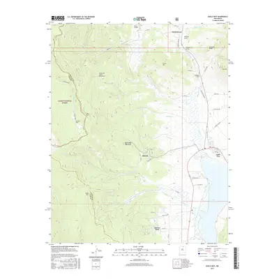
2017 Map of Eagle Nest
USGS Topo · Published 2017About this map
Elizabethtown and the high mountain terrain of the Cimarron Range define this high-altitude landscape in Colfax and Taos counties. The settlement patterns reflect a mix of early mining history and modern recreation, from the historic reach of Humbug Gulch near the northern boundary to the developed Val Verde Ski Area and the lakeside community of Eagle Nest. The rugged topography is dominated by the Sangre de Cristo Mountains and peaks like Taos Peak, which tower over the deep valleys of the Carson National Forest.
Find a feature on this map
50 named features on this map. Tap any name to fly to it.
Don’t see what you’re looking for? This feature index may not catch every label — zoom into the map to look around manually.
Map Details
Editions of this 2017 Eagle Nest Map
This is the sole edition of this map. No revisions or reprints were ever made.
Other maps of this area

1954 · Raton
USGS Topo · 1:250,000

1955 · Ute Park
USGS Topo · 1:62,500

1956 · Tooth Of Time
USGS Topo · 1:62,500

1958 · Raton
USGS Topo · 1:250,000

1963 · Wheeler Peak
USGS Topo · 1:24,000

1963 · Eagle Nest
USGS Topo · 1:24,000

1963 · Red River Pass
USGS Topo · 1:24,000

1963 · Red River
USGS Topo · 1:24,000

1965 · Palo Flechado Pass
USGS Topo · 1:24,000

1965 · Pueblo Peak
USGS Topo · 1:24,000