
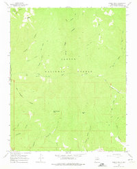
1965 Map of Pueblo Peak
USGS Topo · Published 1968About this map
Carson National Forest dominates this landscape in the mid-1960s, defined by its complex network of canyons and high summits. Significant historical land divisions are represented by the Antoine Leroux Grant Boundary and the Taos Pueblo Grant Boundary, which intersect the terrain near Pueblo Peak. The mapping reflects a transition from traditional footpaths to more modern access, showing the Simpson Memorial Trail and the Kit Carson Trail alongside various Pack Trails and a newer Jeep Trail. Drainages like Rio Pueblo de Taos and Frijoles Creek carve deep into the topography, while a lone Cem near the southern border and a named Spring near Palo Encebado Peak indicate small pockets of human activity in an otherwise high-elevation wilderness. This survey captures the specific arrangement of these old land grants before later 20th-century development altered the periphery.
Find a feature on this map
28 named features on this map. Tap any name to fly to it.
Don’t see what you’re looking for? This feature index may not catch every label — zoom into the map to look around manually.
Map Details
Editions of this 1965 Pueblo Peak Map
2 editions found
Other maps of this area

1954 · Raton
USGS Topo · 1:250,000

1958 · Raton
USGS Topo · 1:250,000

1963 · Wheeler Peak
USGS Topo · 1:24,000

1963 · Eagle Nest
USGS Topo · 1:24,000

1963 · Arroyo Seco
USGS Topo · 1:24,000

1964 · Taos
USGS Topo · 1:24,000

1964 · Ranchos De Taos
USGS Topo · 1:24,000

1965 · Osha Mountain
USGS Topo · 1:24,000

1965 · Palo Flechado Pass
USGS Topo · 1:24,000

1965 · Shady Brook
USGS Topo · 1:24,000